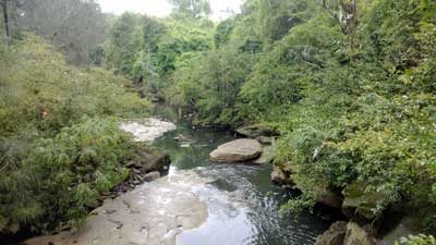
Cooks River, Belfield
Cooks River
The first river to be recorded on any map of Australia, the Cooks River was explored by James Cook in 1770 who marked it on his map of Botany Bay. Rising in Strathfield and flowing through Belfield, Campsie, Canterbury, Earlwood and Marrickville to enter Botany Bay at Tempe, the river's natural environment has largely been destroyed by urban development and industry, but in recent decades the Cooks River has been the subject of numerous projects to bring it's original environment back to life. These days virtually the entire length of the River is concrete lined or piped, and the channel itself has been straightened and realigned in a number of places.
Parks located at various stages along its banks allow access to the river and walking tracks which afford pleasant, relaxed strolls. Public transport: train to Dulwich Hill, walk south along Wardell Road; or train to Canterbury, walk south along Canterbury Road; or train to Tempe. Salt Pan Creek
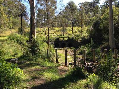
Salt Pan Creek is a tributary of the George River. A pedestrian boardwalk track gives access to 6 kilometres of its shoreline, part of which passes through a natural mangrove community. The boardwalk is linked to the suburbs of Riverwood and Padstow by a bridge built over the creek at Lillian Street, Riverwood (next to the railway line). An access ramp provides entry for disabled people. A map of the boardwalk is available from the Hurstville Council (phone (02) 9542 0648). Access the walk from Lillian Road, Riverwood or by foot off Henry Lawson Drive.

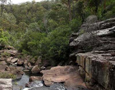
Wolli Creek
Wolli Creek
The Wolli Creek Valley contains the only bushland of any size and the only large high-quality open space left in the heavily populated and industrialised suburbs of inner southern Sydney. Mangrove and saltmarsh flats were once common in the estuary of the Cooks River, downstream of Tempe. These have now been filled, leaving those along the Wolli Creek and Muddy Creek among the few remaining saltmarsh remnants in the Cooks River system.
Today the creek is a lined channel upstream however the lower reaches to the Cooks River is largely in a "natural" state forming a defined but winding watercourse through the Wolli Valley. A path alongside the creek makes for an enjoyable, easy walk. The best access it through Girrawheen Park, Earlwood. The park is a nature reserve with scattered grassed areas serviced by toilets, picnic and barbecue facilities. The central section of the valley is reached via a pathway leading east from the grassed area.
The roofs of the valley's rocky overhangs have been blackened by the smoke of thousands of campfires and are the last remaining evidence that Aborigines who once lived here. In contrast are the exotic plants which have engulfed the valley, particularly along the water's edge, that have grown from seeds washed down from the "European" gardens of nearby homes. They reflect the drastic change to the bushland environment that was brought about by the arrival of the white man.
Bardwell Creek
The major tributary of Wolli Creek, with its confluence located at Arncliffe some 2.5 kilometres upstream of the Cooks River junction. The upper reaches of Bardwell Creek arise in Hurstville to drain in a north-easterly direction through the suburbs of Hurstville, Bexley North, Bardwell Park and Turrella. Though radically changed since pre-colonial days, Bardwell Valley is a pleasant area for walkers with pockets of natural bushland surviving amongst the introduced flora and grassed areas which dominate this reserve. A 6ha. remnant of closed forest is located south-west and north-east of Bexley Road and has been earmarked for preservation.
A walking path follows the line of Bardwell Creek along its southern bank from Preddy's Road, Bexley North, to Bardwell Road, Bardwell Valley, near where the creek flows into Wolli Creek. Be aware that the valley is subject to flooding after heavy rains. Public transport: train to Rockdale, Bus No. 72; or train to Burwood or Bondi Junction, Bus No. 400. Alight on Bexley road near bridge over Bardwell Creek.
Bardens Creek
Recalls Alfred Barden whose pioneering family was associated with the Bangor area prior to the 1850s.
Muddy Creek
Descriptive. Also known by the names Slacks Creek and Black Creek, it is a tributary of the Cooks River which enters it from the south after passing through the suburbs of Brighton-Le-Sands and Kogarah. Around the turn of the 20th century, it was going to be turned into a canal to ship produce by barge direct from the market gardens on its banks to the markets of Sydney.
Morgans Creek
Recalls HR Morgan, the first land grantee in the area in 1842. It flows into Cooks River.
Cup and Saucer Creek
A small waterfall once existed here, which gave the impression of water flowing out of a cup and into a saucer. It flows into Cooks River.

Alexandra Canal
Alexandra Canal (Shea's Creek)
The name Alexandra is believed to have been derived from Stanley Alexander, Under secretary of Public Works, who first muted the idea of dredging and the repair and extension of the embankments of Sheas Creek into a fully operational canal. Before its conversion into a canal was completed in 1891, this waterway was known as Shea's Creek, after First Fleeter, John Shea, Captain, HMS Scarborough, who came across it during a hunting expedition.
Bunnerong Creek
The name is of Aboriginal origin. Believed to be the Aboriginal name for the locality.
Patmore Swamp
Thus named because it bordered on the land grant of Patrick Moore. It was reclaimed and called Scarborough Park in 1879, recalling the time the First Fleet transport Scarborough had anchored in Botany Bay in 1788 and therefore already has associations with the area.
Bado-berong Creek
An Aboriginal word in the Eora dialect of the Darug language meaning small fish.
Goomun Creek
Aboriginal word in the Eora dialect of the Darug language for the Casuarina tree.
Waradiel Creek
Aboriginal word in the Eora dialect of the Darug language for a mullet.

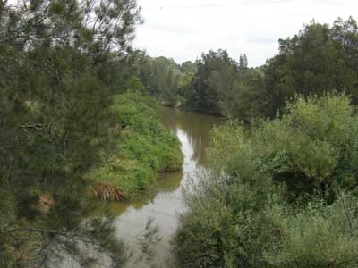
Georges River, Milperra
Georges River
It is believed the river was thus named by Gov. Phillip after the reigning monarch, however this has never been verified. When Capt. Hunter first surveyed it in 1788, he named it West River. By 1795 it was commonly referred to as Georges River but in that year Hunter referred to it as South West River.
Kelso Creek
Charles Kelso who, with the Frere Family, established a successful vineyard in 1889 known as "Beausejour" at Eckersley, a former settlement within the boundary of the Holsworthy Military Area. The creek flows into the Georges River.
Cunningham Creek
Recalls a grantee who received land here in 1804. The creek flows into the Georges River.
Williams Creek
100 acres in the Holsworthy area was granted to First Fleeter John Thomas Williams in August, 1809. This land is situated at the confluence of Williams Creek and the Georges River on the eastern side of Williams Creek which bears his name. The creek flows into the Georges River.
Mill Creek
Recalls a grain mill which operated here to the west of Barnes Crescent in the 1920s, the remains of which, and an associated weir across the creek, are still visible by the creek. The weir acts as an artificial boundary between the tidal and freshwater sections of Mill Creek. The creek flows into the Georges River.

Woronoma Bridge over the Woronora River
Woronora River
The name is of Aboriginal origin, recorded by Robert Dixon in 1827 as Wooloonora - a native word meaning 'place of no sharks'. Woronora is also an Aboriginal word meaning 'SouthCk_StMarys rocks'.
Still Creek
It is presumed a still once operated near it.
Temptation Creek
The name's origin is unknown.
Campbells Creek
Recalls Keith Campbell, Captain, Heathcote Bushfire Brigade. He was killed in the area fighting a bushfire on 9th January 1983. Formerly Little Temptation Creek.
Carina Creek
An Aboriginal name believed to have the same origin as the nearby suburb of Kareela. It is derived from the Aboriginal word 'kari-kari' meaning 'fast'. Alternate suggested meanings are 'place of trees and water' or 'south wind'. The creek flows into Carina Bay.
Melinga Molong Gully
The Creek flows into Woronora River. The name is of Aboriginal origin, recorded by Robert Dixon in 1827.
Crescent Creek
Named after an area of natural bushland and a road, both known as The Crescent, through which the creek flows.
Fire Creek
The Creek flows into Woronora River. The name's origin is unknown.
Forbes Creek
Believed to honour F.E. Forbes who operated sawpits with convict labour at Holsworthy from 1832. The Creek flows into Woronora River.
Loftus Creek
Lord Augustus William Spencer Loftus, a former Governor of NSW (1878-85), after whom the area through which the creek flows is named. The Creek flows into Woronora River.
Fahy Creek
Believed to have been named after an early settler. The Creek flows into Woronora River.
Maandowie Creek
The name recognises the area's stands of Grey Gum trees. (Grey Gum,Eucalyptus punctata De Candolle, Maandowie). The Creek flows into Woronora River.

Hacking River, Royal National Park
Hacking River
The river and the inlent into which it flows were named after Henry Hacking, quartermaster HMS Sirius of the first fleet, who was the Port Jackson harbour pilot. He discovered the waterway on a kangaroo hunting trip in 1788. Thus named by George Bass and Matthew Flinders in 1796.
Savilles Creek
Believed to have been named after an early settler. The Creek flows into Woronora River.
Temptation Creek
The creek flows into Savilles Creek.
Dents Creek
Origin unknown. Believed to have been named after an early settler. In 1887, three unsuccessful bores were sunk beside the creek in search of a mineable coal seam. The Creek flows into Hacking River.
Bee Creek
Origin unknown.
Coonong Creek
Origin unknown, possibly Aboriginal.
Girronba Creek
Oigin unknown, presumed Aboriginal.

Alcharinga Creek waterfall, Miranda
Alcheringa Creek
The Creek flows into Woronora River. Oigin unknown, presumed Aboriginal.
Wallaby Gully
Presumably because wallabies were seen in the gully when first explored.
Lyretail Gully
Presumably because lyrebirds were seen in the gully when first explored.
Wappa Creek
Of Aboriginal origin.
Heathcote Creek
Named by Surveyor-General Sir Thomas Mitchell in 1835 in honour of an officer who had fought with him in the Peninsular wars against Napoleon.
Myuna Creek
Of Aboriginal origin.

Kingfisher Creek, Heathcote National Park
Kingfisher Creek
Probably named because kookaburra (commonly mistaken for kingfishers by the early white settlers) were seen here.
Mirang Gully
Origin unknown.
Spion Kop
The name of a hill. It is possible that this is derived from the name Spion Kopje, an Afrikaans name for a feature in South Africa that became well known during the Boer War.
Origma Creek
Takes the name of the Rock Warbler (Origma Solitaria).
Scout Creek
A campground used by Boy Scouts for many years is located nearby.
Prestons Gully
Origin unknown.
Boggywell Creek
Origin unknown.
Carina Creek
Oigin unknown, presumed Aboriginal. The watercourse flows through an area unofficially known as Kareena Park. This name appears to come from the name of a road nearby.
Engadine Creek
Named in the late 1890s by local residents, the McAlister family, who went to Europe for a holiday and upon their return, named their property after the Engadine area of Switzerland which they had visited.
South West Arm Creek
Enters into South West Arm of Port Hacking.
Saddle Gully
The gully is alongside a high ridge or saddle.
Cabbage Tree Creek
Extensive number of cabbage trees seen here by early explorers.
Marley Creek
Thought to be the Aboriginal name for the creek. Its meaning is unknown.

Wattamolla Creek
Wattamolla Creek
Thought to be the Aboriginal name for the creek. Its meaning is unknown.
Curracurrong Creek
Thought to be the Aboriginal name for the creek. Its meaning is unknown.
Curra Brook
Thought to be the Aboriginal word for a creek.
Bola Creek
Thought to be the Aboriginal name for the creek. Its meaning is unknown.
Waterfall Creek
It rises near the suburb of Waterfall.
Palona Brook
Origin unknown.
Uloola Brook
Thought to be the Aboriginal name for the creek. Its meaning is unknown.
Kangaroo Creek
Presumably because kangaroos were seen in the gully when first explored.
Cridland Brook
Local resident and historian, Frank Cridland, who wrote the book, "Port Hacking, Cronulla and Sutherland Shire" (circa 1924).
Goonderra Brook
The Aboriginal name for the creek. Its meaning is unknown.
Engadine Creek
It rises near the suburb of Engadine.
Forest Brook
Descriptive
Tuckawa Rill
The Aboriginal name for the creek. Its meaning is unknown.
Platypus Creek
Presumably because platypus were seen in the gully when first explored.